BUILD ON SOLID GROUND™
Geotechnical data management that transforms geodata into decisions.
The #1 geodatabase management software, built by geotechnical engineers. Your data stays yours forever with flexible storage options. Seamlessly connect with industry software while maintaining full control and transparency.
Strategic partners

Trusted worldwide by geotech engineers for 15,000+ projects at
Our 30-year impact in numbers
Used in more than
15.000
Geotechnical projects
Sampled over
2
million
Borehole logs
Used in
51
Countries

How does GeoDin benefit geotechnical engineers?
GeoDin® supplies cutting-edge geodata management software for geotechnical engineers to create robust geodatabases and visualize what's beneath the ground.
How geotechnical engineers benefit from GeoDin
GeoDin is engineered to meet the rigorous demands of large-scale infrastructure development, offering a comprehensive suite of tools that streamline your geotechnical workflow from investigation to design and beyond.
Ease of mind
Building quality geodata sets is challenging. GeoDin helps you assess data quality, determine cut off points, and eliminate errors.
Freed up agenda
GeoDin streamlines geodata workflows, saving you time so you can focus on advanced analysis and strategic thinking.
Custom models
GeoDin isn't a black box. Customize our models to match your engineering ideas and create optimal solutions.
How GeoDin Suite works - in 3 steps
An advanced collection of specialized tools designed to support every aspect of your geotechnical workflows.
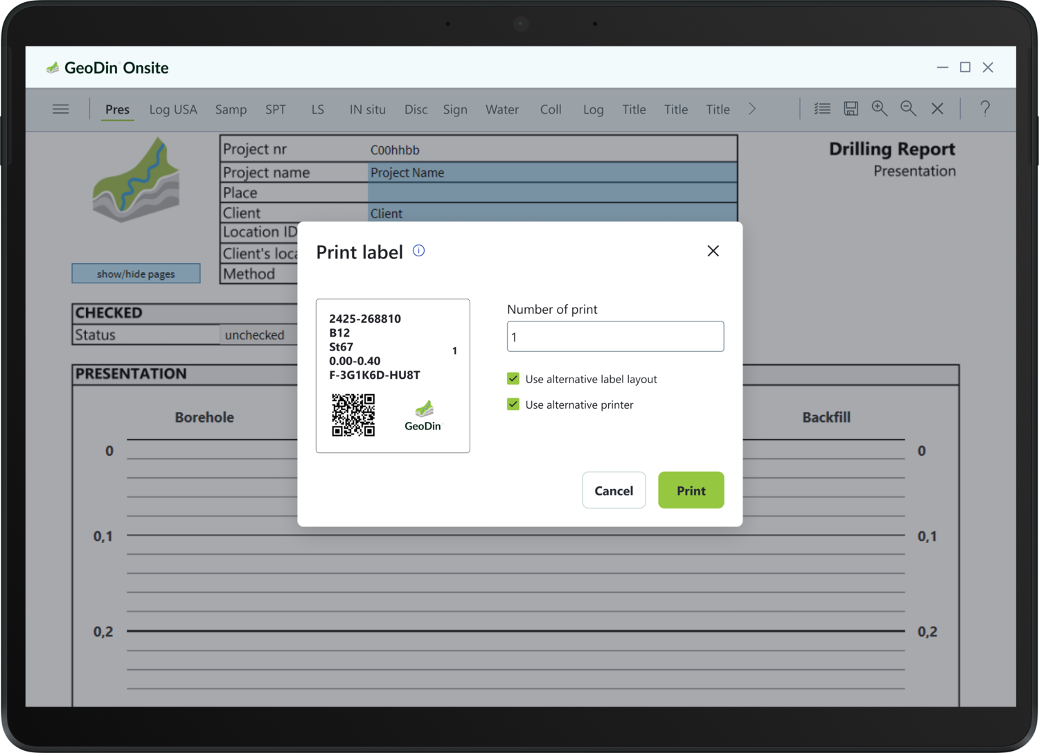
Digitally collect field data with GeoDin Onsite app
- As easy as logging on paper
- Automatic checks on errors
- Import data in GeoDin
- Bonus: sample label printing with QR

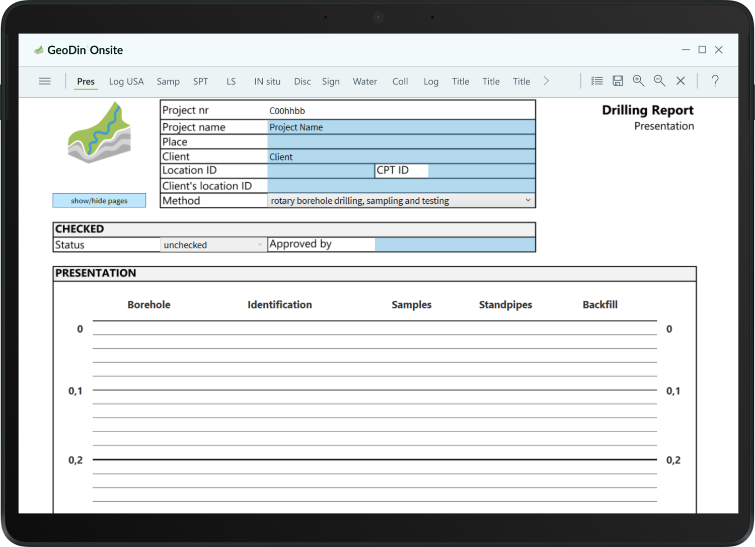
Build the best geodatabase and reports with GeoDin
- Compliant with industry standards
- You choose storage and residency of geodata
- AGS export, gINT migration and much more

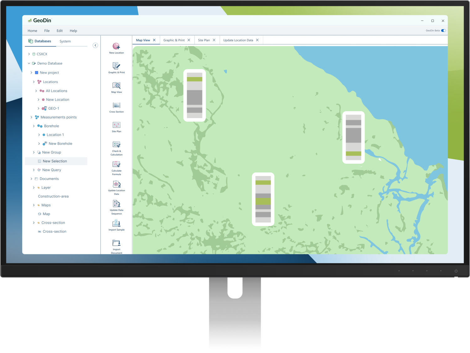
Visualize geodata in Civil 3D with GeoDin Ground
- Import GeoDin dataset in Civil 3D with GeoDin Ground app
- Advanced visualizations, model creation and document viewer
- Better, safer and cost-efficient designs
GeoDin is used in various industries to help build on solid ground


“GeoDin is an ideal combination of client-server software with all the advantages of a typical multi-user database solution and a high-specialized software for our subject matter experts.”

GeoDin Suite consists of GeoDin Onsite, GeoDin, and GeoDin Ground
A powerhouse, created, tested and used intensly by the world's best geotechnical engineers.


Frequently Asked Questions
If you don’t see your question here, we’re always available to help.
Get in touch to discuss your needs, explore opportunities, or clarify how we work.