GeoDin Onsite: capture ground data onsite digitally​

What's better than entering ground data on paper? We know - hardly anything beats a quick write-down on paper. But we knew this process could be improved, being ground experts ourselves. So we took the paper forms and digitized them - and added a bunch of brilliant features to it. So now you can enter your ground data like you're used to, on paper, but in a much faster, safer and smarter way. GeoDin Onsite is here!

GeoDin proudly presents GeoDin Onsite, an app for Windows tablets, laptops and desktop. GeoDin Onsite allows for easy, validated ground data capturing. The data can be seamlessly entered into GeoDin.

Besides easy data capturing, the app also offers label printing with QR, to make sample registration a simple task, and to prevent data loss or mix-up. And finally: the app can also include sample photos.

Data logging like 'on paper'

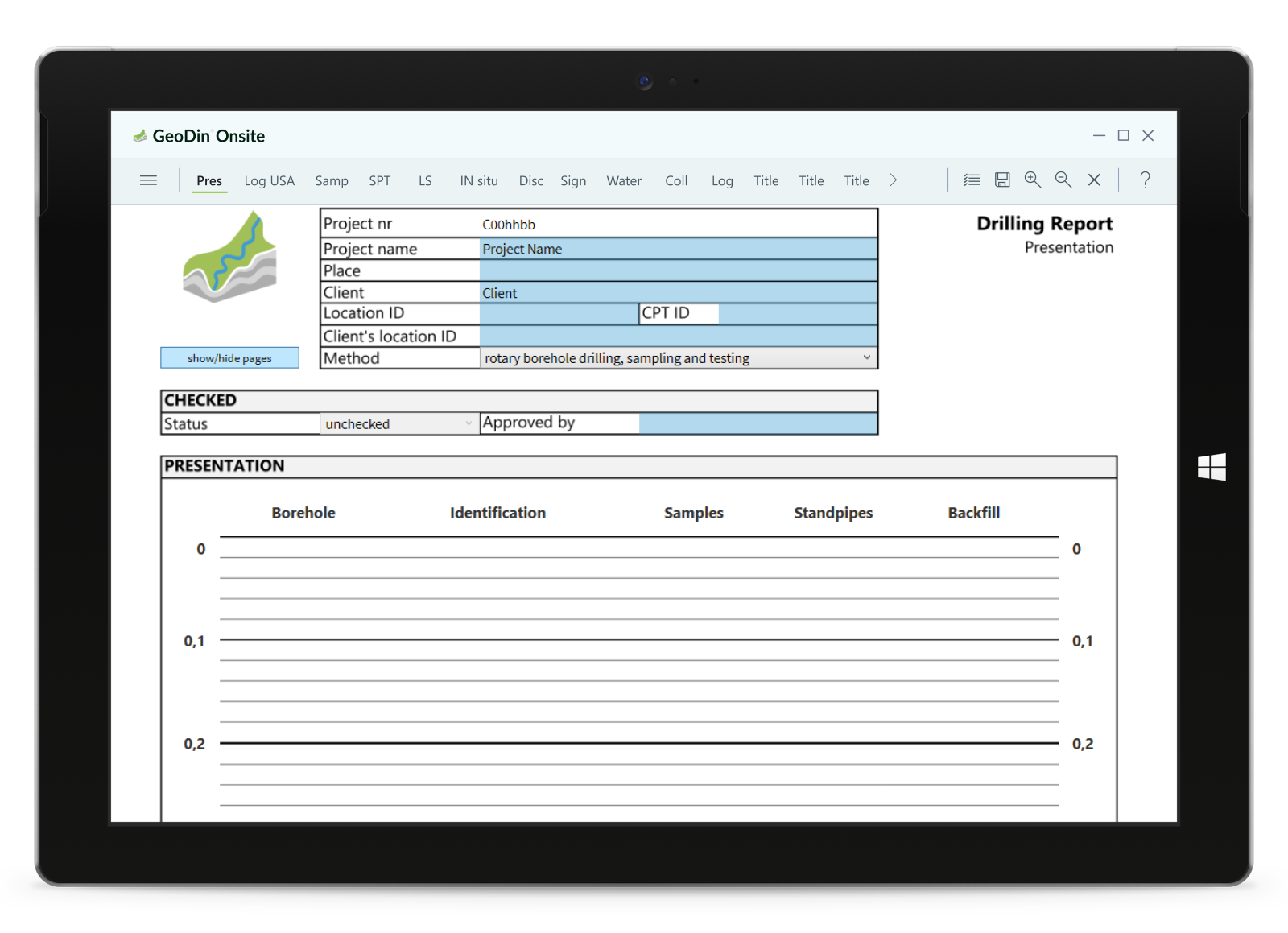
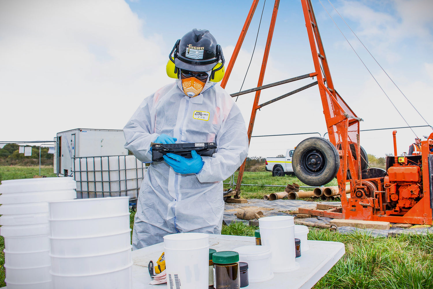
In these digital times, we sometimes long for the simplicity of paper. We know. Therefore, we created an app that is as similar to data entry on paper as it possibily can be. You can choose between touchscreen or keyboard entry. We've added smartness and sturdiness to the app so your data is entered better and kept safe. So no more rain and dirt destroying your precious borings.

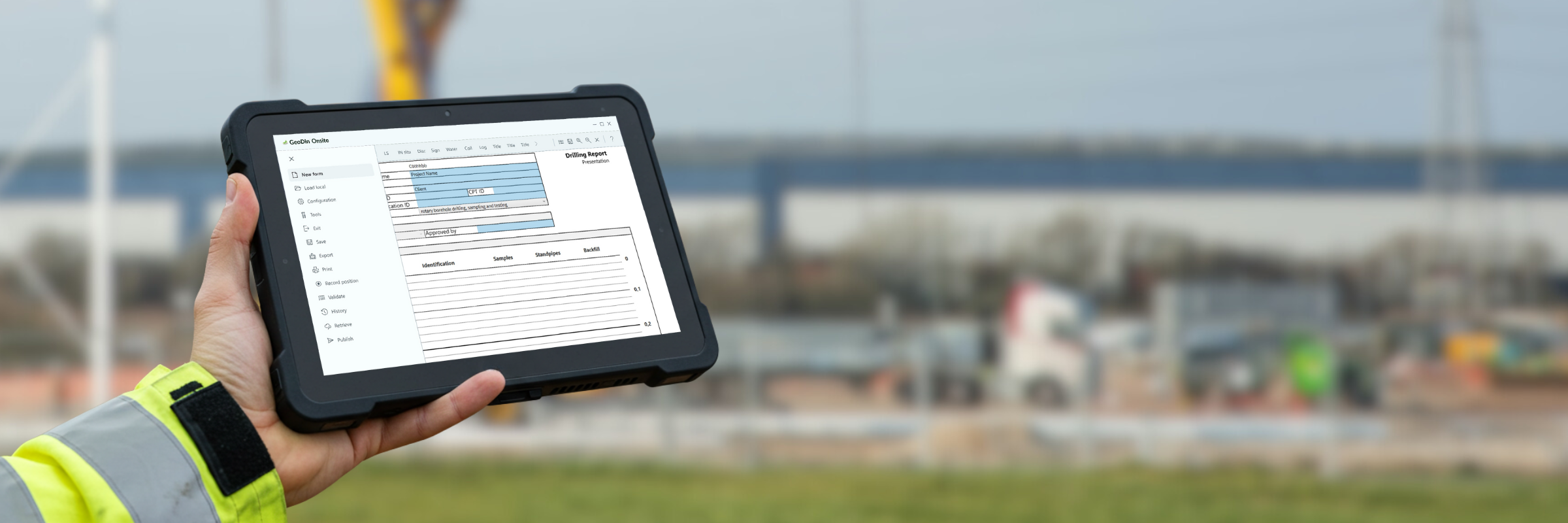
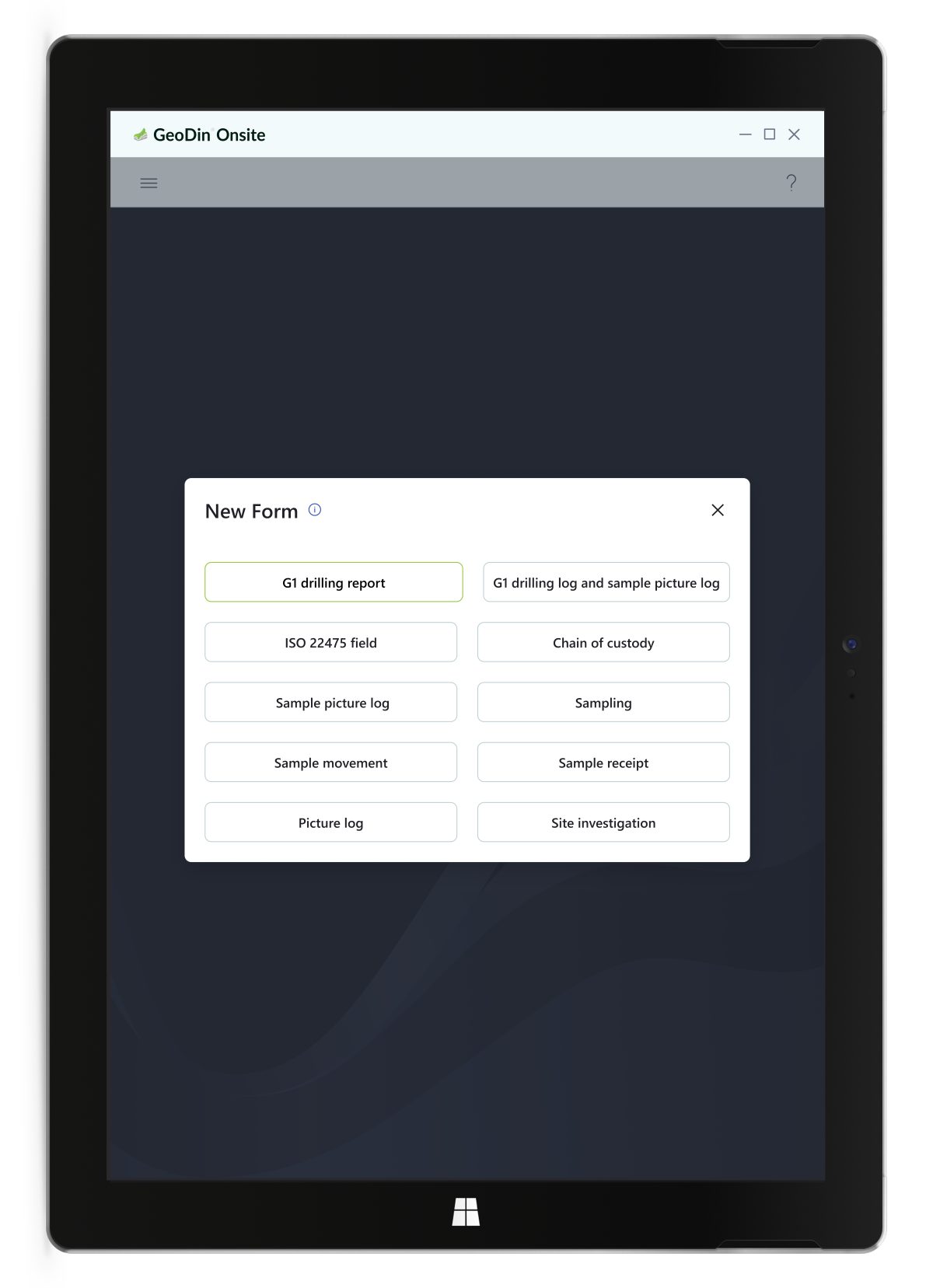
GeoDin Onsite replaces paper forms with a tablet interface, providing a digital equivalent for field data capture. This simplifies the transition for personnel and cuts down on transcription errors. Users input data directly, and the app validates entries in real-time. It checks for correct data types and completeness, and enforces conditional rules based on field conditions, ensuring higher data quality and a streamlined workflow.  

Digital entry allows for immediate validation, with GeoDin Onsite instantly verifying entries and checking for completeness. The app's ability to enforce conditional rules ensures data adapts to specific requirements. This validation enhances data quality and streamlines workflow efficiency

Label printing with QR

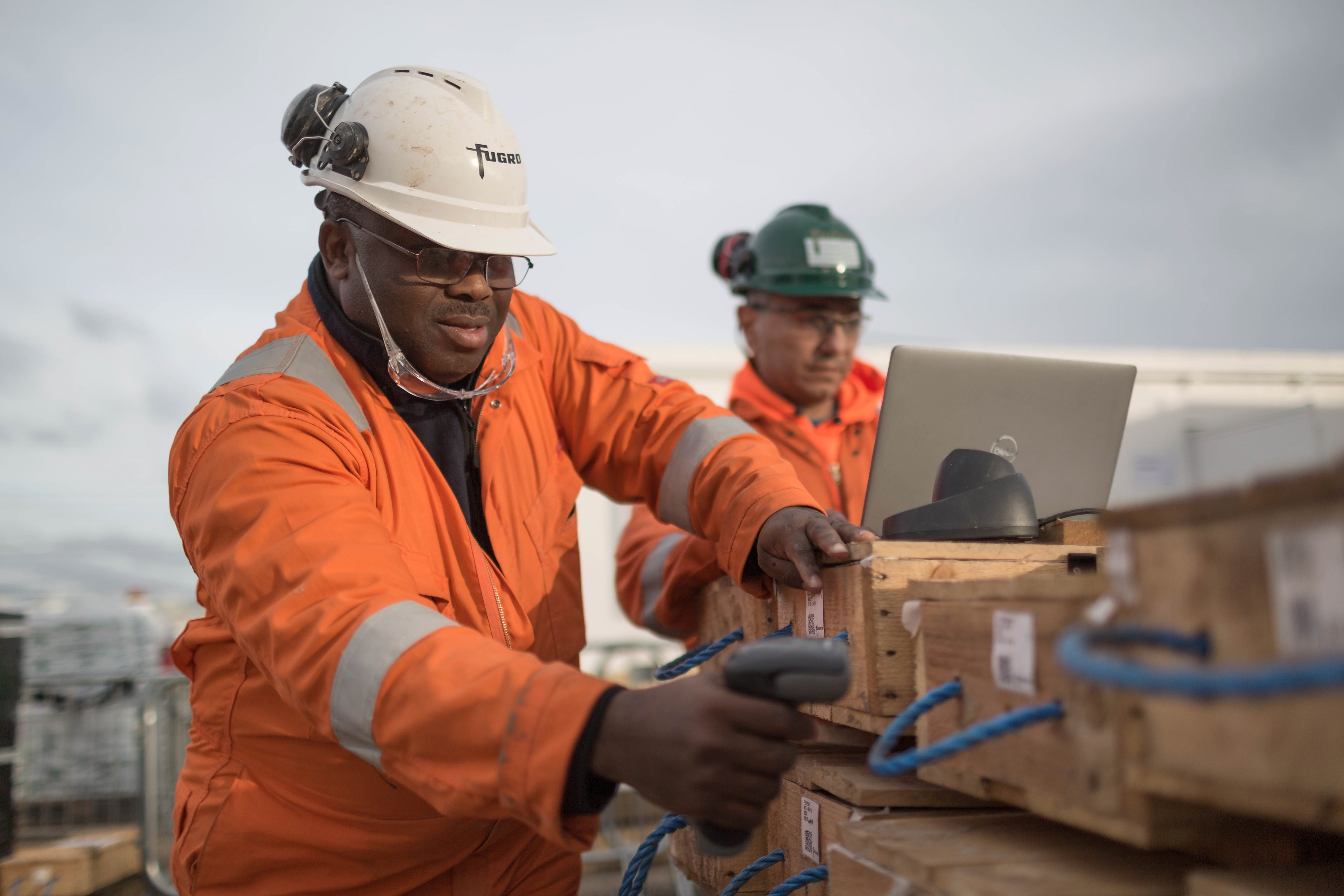
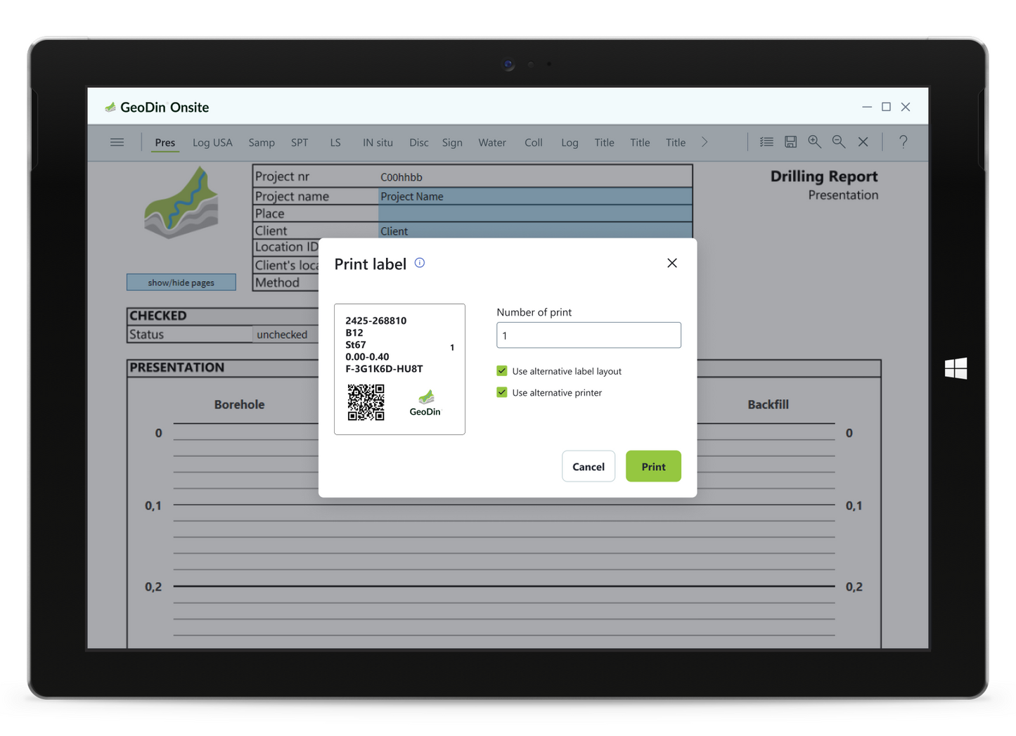
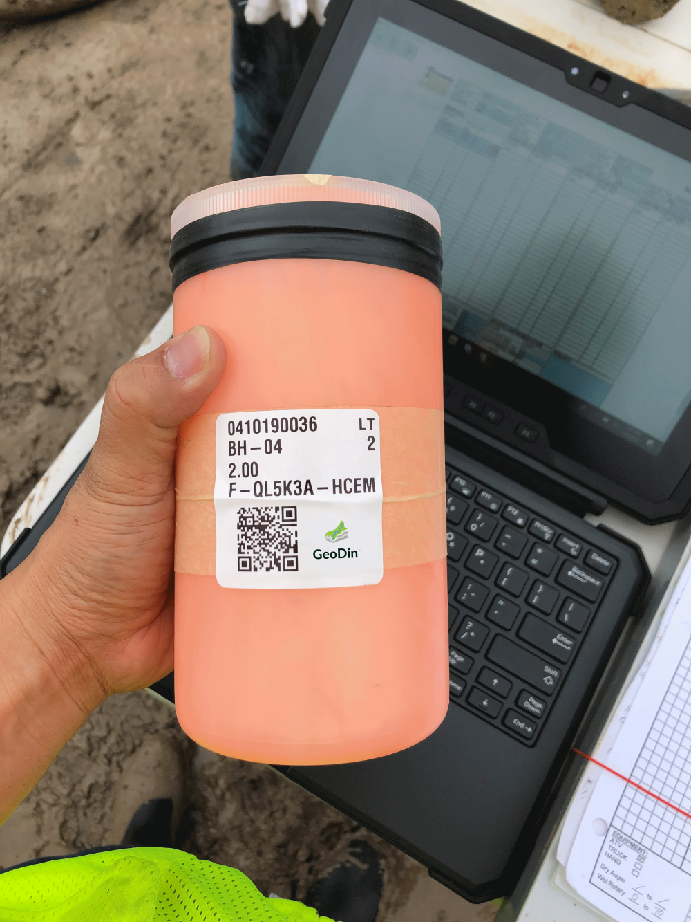
And this is where it gets really interesting: our app allows for automatic label printing for every sample that you take! No more lost samples or mixed up test results.

GeoDin Onsite enables the creation of unique identifiers for samples in the field, eliminating manual labeling. The app generates labels with QR codes containing essential sample information. This automation ensures accurate and efficient sample marking.  

Generated labels include project number, location, depth, and sample type within the QR code. You can now trace your lab results back to the field, and have quick access to sample details by scanning the QR code, even with delays in data transfer.


Include sample photos

GeoDin Onsite allows users to integrate media like photographs into digital forms. Field personnel can capture visual documentation of samples or site conditions and link them to data entries. This eliminates separate documentation and keeps visual evidence with collected data.  

Integrating photos provides a more comprehensive record, enhancing the reliability of analyses. Visual data alongside measurements improves communication and collaboration among teams and stakeholders.  

  • 1. Install GeoDin Onsite app

    Download the app and install it on a Windows tablet or laptop. The trial is valid for 6 months (contact sales@geodin.com for extended access).

  • 2. Start measuring & logging

    Use GeoDin Onsite to collect all ground data, just as you would on paper. Only now, the data is checked for anomalies and saved in a secure environment.

  • 3. Import data in GeoDin

    Export the measurements from GeoDin Onsite and import them in GeoDin. See all details and turn your measurements in stunning reports to share with the team.

All features of GeoDin Onsite

  • Digital data entry: GeoDin Onsite allows users to directly input geotechnical data into a digital form on a tablet, mirroring the traditional paper forms used in the field.   
  • Data validation: The app validates data entries thoroughly, ensuring accuracy by checking for correct data types (e.g., numbers vs. letters) and completeness, and enforcing conditional rules based on specific field conditions or methods.   
  • Sample identification and labeling: It enables the creation of unique identifiers for samples and automates the printing of labels with QR codes, containing essential sample information like project number, location, depth, and sample type. The app can be linked to (industry-standard (i.e. Zebra branded) mobile label printers via bluetooth. It can also connect via standard wires.
  • Integration of media: Users can capture and embed photographs of samples directly within the data entry form.   
  • GPS integration: The app can capture GPS coordinates at the time of data entry.
  • Offline functionality: GeoDin Onsite is designed to work offline, allowing for data capture in areas without internet connectivity, with a requirement to connect periodically (e.g., every 30 days) to validate the license.   
  • Windows-based application: The application is specifically designed for Windows tablets, laptops and PCs. It can run alongside GeoDin on a computer.  


GeoDin Onsite FAQ

What is GeoDin Onsite? 

GeoDin Onsite is a Windows-based application designed for efficient geotechnical data capture in the field, replacing traditional paper forms with a digital interface on a tablet.

What type of devices does GeoDin Onsite run on? 

GeoDin Onsite runs on Windows tablets or Windows PCs. It is optimized for larger form factor tablets.

Does GeoDin Onsite work offline? 

Yes, GeoDin Onsite is designed to work offline. You only need an internet connection to validate the license periodically.

Is GeoDin Onsite a mobile app?

No, it is a field application, not a mobile app. It is designed for Windows tablets and PCs, not smartphones.

How does GeoDin Onsite improve data entry? 

It provides a digital form that mirrors paper forms, allowing for direct data input, real-time validation (e.g., checking for correct data types and completeness), and conditional rules.

What does the sample identification and labeling feature do? 

It enables the creation of unique identifiers for samples and automates the printing of labels with QR codes, including essential sample information.

Can GeoDin Onsite integrate media? 

Yes, users can capture and embed photographs directly within the data entry form.

What information is included in the QR code on the sample labels? 

The QR code includes the project number, location name, depths, depth range, and sample type.

Does GeoDin Onsite connect directly to the GeoDin database? 

The import of data from GeoDin Onsite to GeoDin works via the export/import functionality.

Can data collected with GeoDin Onsite be exported? 

Yes, data collected with GeoDin Onsite can be transferred. Supported export formats are detailed in the application's documentation.

Is GeoDin Onsite available for Android or iOS? 

No, it is currently only available for Windows.

What are the hardware requirements for GeoDin Onsite? 

It requires a Windows 10 or 11 device. It does not need to be a touchscreen device, but is optimized for tablets.

What does GeoDin Onsite cost?

GeoDin Onsite will be free for the first 6 months. Reach out to sales@geodin.com for more information.

Questions about GeoDin Onsite?

Reach out to our team at sales@geodin.com.