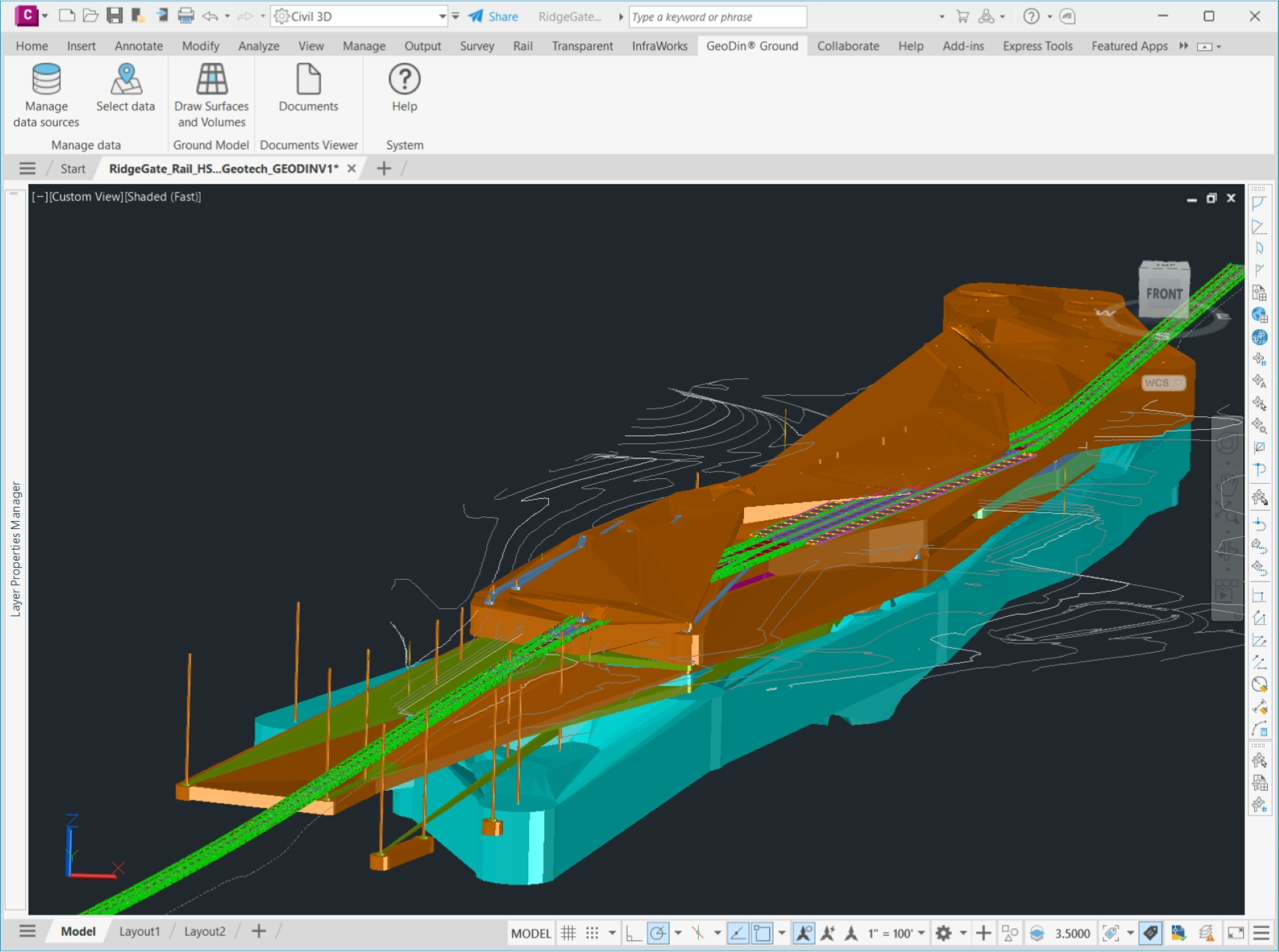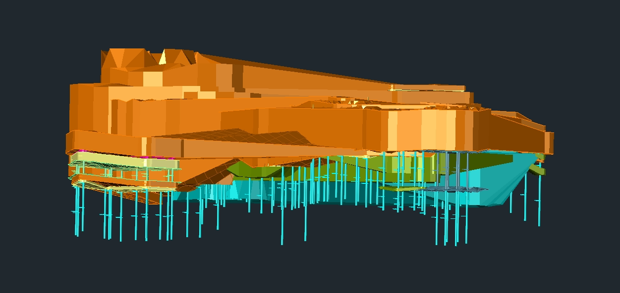
See below the ground with GeoDin Ground Civil 3D app
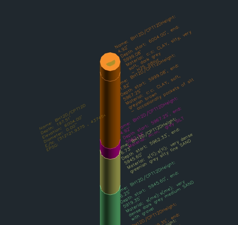
Boreholes directly visible in Civil 3D
As design engineer, do you recognize this dilemma? You’ve got a certain design to work on, but there’s one major unknown: the ground you’re building on. What does it consist of, what foundation do you need to prepare for? Are there any unexpected risky situations, or do basic measurements do?
Here's your solution: the GeoDin Ground app for Civil 3D allows you to integrate ground data in your designs, enabling you to create perfect designs that are fully tailored to the ground it stands on.
So what ground data are we talking about?
- Borehole information
- Standard-compliant lithological layer descriptions
- Sample data
- Data obtained from methods such as CPT investigations
- 50+ classification and advanced geotechnical tests
Are you a designer?
Designers are now able to see below the ground in their design environment, instead of having to tend to multiple different sources of data to design a solid foundation. This leads to huge time and cost savings, to greater sustainability in building and to reduced risks.
Are you a geotechnical engineer?
For geotechnical engineers, GeoDin Ground is a great relief. Their work, an advanced overview of the ground conditions, can now be viewed in all its glory, directly in Civil 3D. It results in a stronger and more efficient workflow amongst building and construction teams.
Download GeoDin Ground now