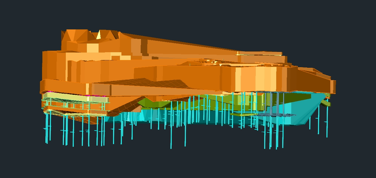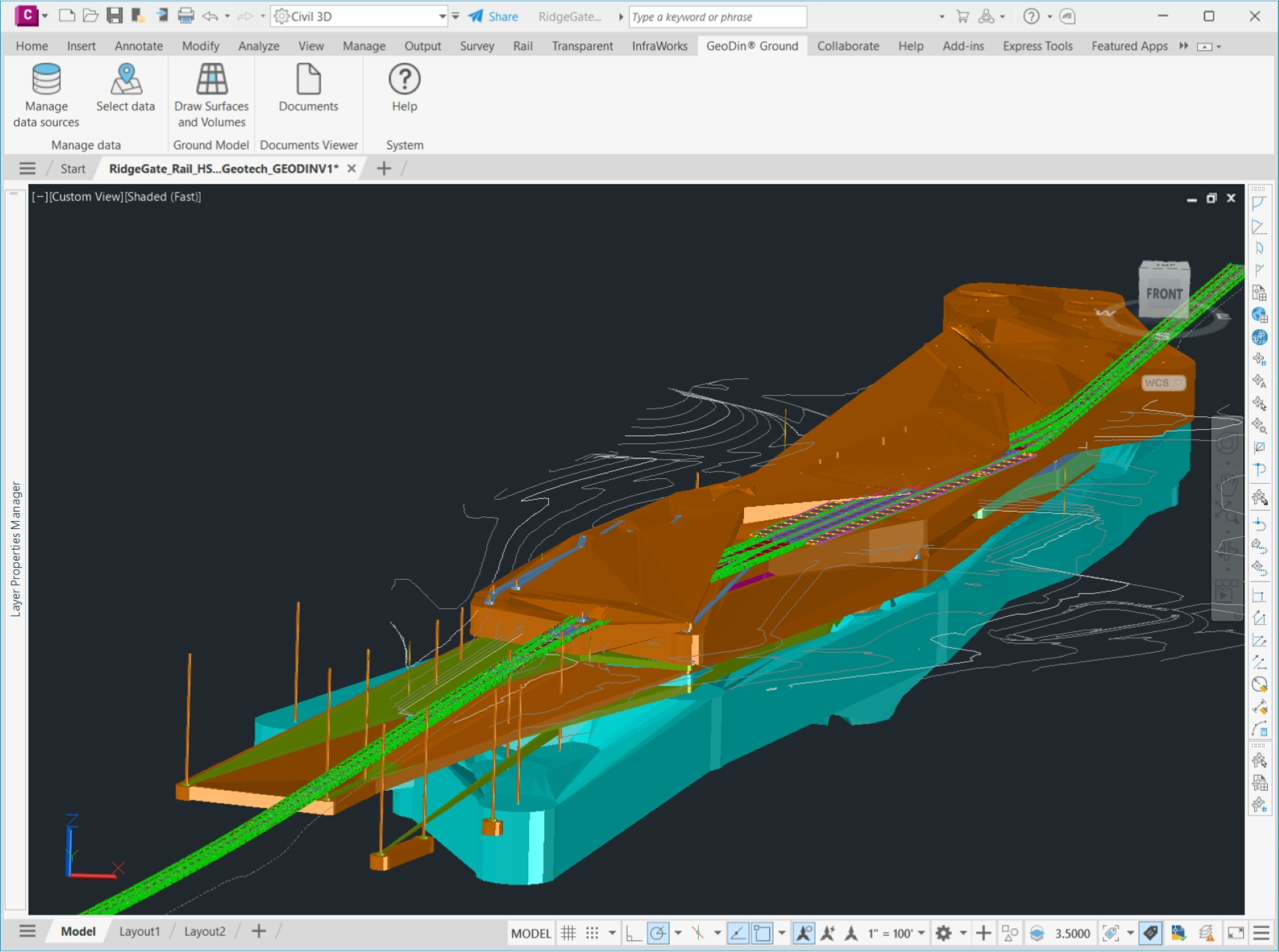
See below the ground with GeoDin Ground Civil 3D app
GeoDin Ground is an app developed by GeoDin® and Autodesk for civil and design engineers to see below the ground in Civil 3D. With the integration and visualization of ground data in Civil 3D, the information gap between ground and design is closed.
GeoDin Ground is a comprehensive solution offered to tackle the challenges faced by design teams and geotechnical engineers.Traditional methods of incorporating ground data into designs relied a lot on using separate sources of data and file types.
GeoDin® offers you the possibility of having a single source of truth for your geodata. With GeoDin Ground, you are able to directly access this data in Civil 3D. This allows you to create designs that are safe, efficient, effective and maximize sustainability, as the risk for overengineering is limited.

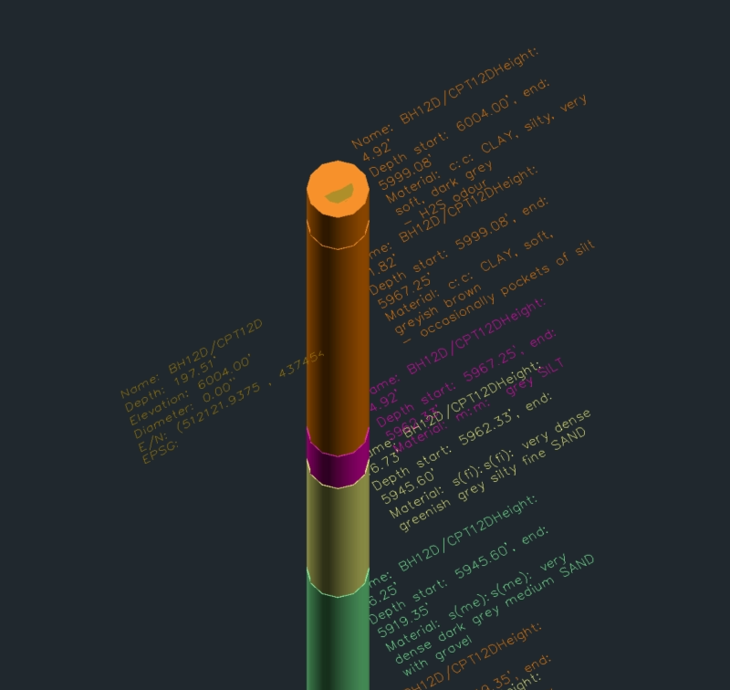
Boreholes directly visible in Civil 3D
As design engineer, do you recognize this dilemma? You’ve got a certain design to work on, but there’s one major unknown: the ground you’re building on. What does it consist of, what foundation do you need to prepare for? Are there any unexpected risky situations, or do basic measurements do?
Here's your solution: the GeoDin Ground app for Civil 3D allows you to integrate ground data in your designs, enabling you to create perfect designs that are fully tailored to the ground it stands on.
So what ground data are we talking about?
- Borehole information
- Standard-compliant lithological layer descriptions
- Sample data
- Data obtained from methods such as CPT investigations
- 50+ classification and advanced geotechnical tests
Are you a designer?
Designers are now able to see below the ground in their design environment, instead of having to tend to multiple different sources of data to design a solid foundation. This leads to huge time and cost savings, to greater sustainability in building and to reduced risks.
Are you a geotechnical engineer?
For geotechnical engineers, GeoDin Ground is a great relief. Their work, an advanced overview of the ground conditions, can now be viewed in all its glory, directly in Civil 3D. It results in a stronger and more efficient workflow amongst building and construction teams.
GeoDin Ground FAQ
Who is the app for?
The app is built for all users of Civil 3D, so it is not limited to a certain audience.
How does GeoDin Ground compare to Geotechnical Modeler?
GeoDin Ground offers significant improvements over Geotechnical Modeler,
including direct database connections, support for more geotechnical data types
beyond soil descriptions, document integration (PDFs, images), and enhanced
model visualization. For a full overview, check out our comparison between GeoDin Ground and the Geotechnical Modeler.
Can GeoDin Ground create advanced geotechnical models?
Yes, GeoDin Ground can create sophisticated models within Civil 3D by importing curated geotechnical data and integrating it with existing Civil 3D models.
What are the main advantages of GeoDin Ground over Geotechnical Modeler?
Key benefits include direct data import for up-to-date information, support for
more geotechnical data types, and contextual integration of individual borehole logs into Civil 3D.
What types of data can the GeoDin Ground app be used with and does it support various formats & sources of geotechnical data?
Types of data supported by GeoDin Ground app:
- Borehole information
- Lithological layer description
- Sample data
- In-situ data (e.g. CPT)
- Geotechnical test
Formats and sources:
- GeoDin export files
- Excel files
- gINT databases
How can I access more advanced geotechnical modeling capabilities?
For advanced functionality, you can use GeoDin Desktop, which offers extensive
geotechnical data management, analysis tools, parameter plotting, cross-section
creation, and report generation.
How does GeoDin Ground perform when working with large Civil 3D models containing numerous boreholes?
GeoDin Ground is designed to handle large geotechnical datasets efficiently. While performance can be influenced by your computer's hardware specifications, the plugin has been rigorously tested with models containing a significant number of boreholes to ensure a smooth and responsive experience.
Does GeoDin Ground automatically refresh data in my Civil 3D model when the underlying geotechnical data changes?
The current version of GeoDin Ground does not feature a live automatic data refresh. However, we understand the importance of this functionality, and a refresh feature is planned for a future release. This will allow you to update your models with the latest data while giving you control over when and how those updates are applied.
Can I directly place and visualize borehole information on profiles and sections within Civil 3D using GeoDin Ground?
While the ability to directly place boreholes on profiles and sections in Civil 3D is
not a feature in the current version of GeoDin Ground, it is something we recognize as valuable and is on our roadmap for future development. We are actively exploring the best ways to integrate this capability to enhance your visualization and analysis workflows.
Do I need a GeoDin subscription to use GeoDin Ground?
No, GeoDin Ground is currently a free app for Civil 3D users. However, it requires
access to a GeoDin database created and shared by a GeoDin license holder.
What features are available without a subscription?
All current GeoDin Ground features are available for free. In 2025, we plan to add CSV and AGS import capabilities to ensure Civil 3D users have access to all functionalities previously available in Geotechnical Modeler.
Will GeoDin Ground remain free?
The current version is completely free. In the future, some advanced modeling
capabilities or soil-structure analysis features may become premium (paid)
features.
What is the cost for GeoDin Desktop?
GeoDin Desktop pricing information can be found at Pricing – GeoDin®.
Can I use GeoDin Ground with a database owned by another company?
Yes, you can use GeoDin Ground with a GeoDin database created by another organization if they provide access or share the database. The Civil 3D user does not need a GeoDin license, only the database creator needs a GeoDin license.

Ready to try GeoDin® for free?
Want to see for yourself what GeoDin is and how it works? You can do so easily by downloading a free trial, no strings attached. All you need to enter now is your work email address and you're ready to work with GeoDin.
-
✔️ Best priced geodatabase
There's no better priced alternative for this complete package. And if you do happen to find one, we'll refund you 100%.
-
✔️ Most complete geotech software
No credit system, no hidden costs, no modules. Just an awesome all-in-one-deal.
-
✔️ Free trial - value $209
Pssst, you did not hear this here... if you have a very short project, use GeoDin for free for 30 days! It will save you $209.
And while you're here... Learn why GeoDin is a perfect alternative to gINT
With gINT phasing out, many of us look for an alternative.
GeoDin is a cost effective and proven alternative for gINT, we
heard from our users. Want to know why we strongly recommend GeoDin as
alternative to gINT?
Most importantly: you'll have the same key functionalities of database building including import of Excel and MS Access files.
✔️ same key functionalities: geodatabase
building
✔️ import Excel files
✔️ import MS Access files
✔️ data ownership
✔️ standardization of database structures
✔️ standards compliance
... and there’s more. Want to learn more?
